


Covered Bridges Locator app for iPhone and iPad
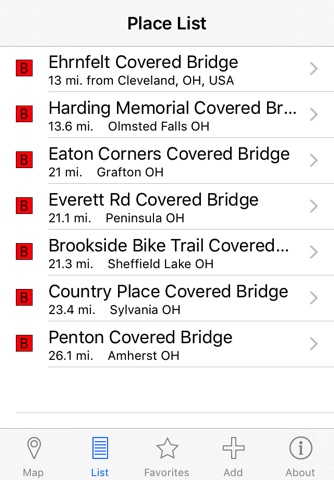
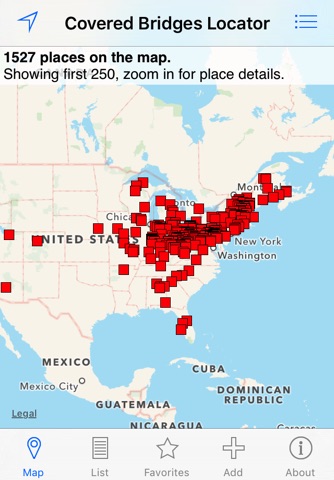
Are words like “truss” and “lattice” part of your everyday vocabulary? Did you watch Bridges Over Madison County just for the architecture? If so, the Covered Brigdes Locator may be the perfect addition to your app library. As your one-stop guide to covered bridges across the US, this handy little app provides the location, aerial view, and architectural background of over 1,500 roofed and enclosed bridges. Search for bridges to visit nearby or read up on ones across the country, virtually touring famous landmarks like The Hartland Bridge (longest covered bridge in the world) and The Roseland Bridge (of Bridges of Madison County fame). Truss me, you’ll beam when you see how far our covered bridge database spans.
Heralded as the solution to weathering and wood decay in 19th century bridge building, covered bridges became a vestige of the past with 20th century advances in steel working and concrete construction. As their number continues to dwindle, historical preservationists have declared many to be landmarks worthy of recognition for their significance to American architecture. Today, tourists flock to covered bridges for a chance to witness a part of history that likely won’t survive for much longer. Don’t miss out; download the Covered Bridges Locator, grab a camera, get in your car, and let the app direct you to the closest covered bridge.
***
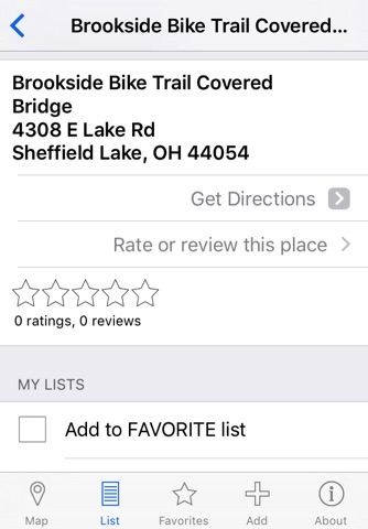
Know of a covered bridge that somehow didn’t make it into the app’s database? Help out your fellow users by pressing “Add” to add it to the map. You can also submit reviews and photos, as well as edit existing information by navigating to www.mapmuse.com in your browser.